Mikhail Orekhov
Those who like to travel, or those whose work is connected with visiting many new places for them, may ask quite a natural question of how to connect a gps navigator to their car. This article will discuss how this device is connected.
Those who are deciding how to install the navigator in the car made the right choice.
Today car navigators are quite complex devices that support gps technology. This system is synchronized with the satellite, which allows the driver to quickly receive data on his own location with frequent data updates. If you install a gps navigator in your car, then the driver gets the opportunity to:
- Move along new and unfamiliar routes;
- Move around the city, bypassing traffic jams;
- Reveal the places where cameras and radars are located;
- Set a route to any point, even in unfamiliar terrain, with the subsequent saving of the worked out route in the device's memory.
The installed high-end navigator, despite its high cost, has a number of undeniable advantages that are relevant for some drivers. First of all, it has an effective blocking mechanism that will provide reliable protection against theft of your equipment. In addition, among other advantages, the following can be distinguished:
- Various additional functions, including entertainment;
- Operator voice notifications about turns and other key points;
- Choosing the most profitable route, as well as calculating the exact cost of the planned journey.
Types of gps navigators
Motorists planning to install a navigator in their car should first decide on the type of device, of which there are three main options:
- Built-in;
- Portable;
- Pocket.
The installation of the built-in navigator in the car is carried out in specialized service centers. Often, the output of the navigator information is carried out directly on a standard monitor in the car, while the control is carried out using sensors. Such navigation equipment is discreetly installed in the panels, and therefore does not take up space directly in the cabin, does not block the driver's view and does not change the interior design of the car as a whole. The installed built-in navigator is powered by a car battery, and the remote antenna will provide a strong and reliable connection with satellites.

Portable models of navigators are installed on a standard mount, which is attached to the windshield with a suction cup. Such a device will already require the use of its own charger. If necessary and at the request of the user, as well as depending on the model of the device, you can create your own navigation complex. Everyone will be able to cope with the installation and configuration of portable navigator options; it can also be placed at the discretion of the driver himself. However, there are a number of general guidelines that should be followed when installing a portable model:
- The navigator should not restrict the normal view from the driver's seat;
- The device has a built-in antenna, and therefore should not be shielded by anything;
- The location of the navigator is obliged to provide a full view of the display by the driver while driving.
In addition to the fact that such a navigator can be easily installed on other cars, or, if necessary, used when hiking, it can also serve as a video recorder. Most modern models are equipped with this function, however, the installation of the navigator in this case should provide the correct camera angle.
Pocket navigation systems are rarely used by drivers as they are less comfortable. Often, the information from such a navigator is voiced by the passenger; in extreme cases, the driver can install it in a holder for a mobile phone or in a cup holder.
Alternative options
Many drivers, in order to save money or because of habit, try to find alternative solutions in matters of navigation. For this purpose, all kinds of devices can be used: mobile phones, tablets, laptops, etc. It should be noted that such solutions are not always as convenient as they might seem. First of all, they will require the installation of all the necessary software and setting up communication with satellites, which must be maintained constantly, as well as the charge of the device itself. In addition, the dimensions of such devices, the way they are fastened and placed in the cabin, as well as the implementation of all kinds of manipulations on them, often bring additional discomfort.
There are no guarantees that an improvised means used as a gps navigator will not make any failure, disconnection, etc. his pocket variations.
Find out how to load maps into the device.
Conclusion
So, based on this information, it is obvious that a navigation device installed in a car allows the driver to receive a lot of advantages. Among the main ones: saving fuel and time, the ability to discover new places, receiving various useful information in real time.
To date, the most accurate devices that allow you to navigate the terrain are GPS navigators, which receive a signal from a satellite and allow you to determine your location thanks to a special program built into them.
In order to connect the navigator to your computer, you will need a special program and a USB cable.
The GPS navigator is a real assistant in the field of orienteering on the ground. However, is it possible either to connect a navigator to a laptop? It is possible, but how exactly to do this is known, unfortunately, not to every owner. And what if you need to upload the necessary information on the navigator to your computer? How to connect the navigator to the computer correctly, and will now be told. The instructions are described below.
- We take one end of the USB cable and insert it into the connector of the navigator, most often it is the mini USB connector. When you are done, turn on the navigator.
- If it happened that your computer could not automatically detect a new device, then you should install the software that is located on the disk that comes with the navigator.
- And so, the program is installed, the computer was able to detect a new device, you can start copying files from one device to another. After everything is done, unplug the cable.
- Next, press and hold the START button, turn off and turn on the navigator.
- This variant of connecting the device navigator to a computer is suitable for analogs of the Treelogic line. In order to connect the GARMIN navigator, you will have to pick up a soldering iron. Such a GPS navigator is connected to the COM port of a computer, to a nine-pin connector, in older models to a twenty-five pin connector.
- In order to make the connection, you will need a three-way cable, which must be stripped first. Data out is carried out via the first wire, which is soldered to the second wire (the third twenty-five-pin) pin of the nine-pin COM connector. Reception of data (data in) goes along the second wire, which is soldered to the third (second twenty-five-pin) pin of the nine-pin COM connector. The third wire is soldered to the fifth (seventh twenty-five pins) pin of the nine-pin COM connector.
- We continue further, connect the unsoldered cable to the COM port of the computer and turn on the navigator. After you are done, unplug the cable.
In conclusion, we can say that GPS navigators have different designs, which means that the methods of connecting to a computer or laptop are different. When connected, a wireless connection such as bluetooth, IrDA and DATA cable can be used. Wireless connection does not have any difficulties, and the software part of the connection, we can safely say, is practically the same.
We all know how navigators have made our life easier, especially for motorists. These devices allow the driver to have no doubts about the correctness of the laid route and to know about the presence of a traffic jam before he gets into it.
But for it to work correctly, you need to know how to connect the navigator to the Internet to ensure its connection with the satellite. To connect to the Internet, you need to verify that you have met a few initial requirements. First of all, the phone must have configured GPRS Internet, and the navigator must have the same DUN profile and the ability to launch the "Control Panel". The keyboard program (MioTool) and PdaNet may also come in handy.
This miracle of technology will also come in handy for travelers. Portable navigators with various options and modules will greatly facilitate the journey and allow you to leave at home maps, compasses and other devices that burden the journey. But how to plan a route on a navigator for a novice traveler who first picked up a navigator? Everything is very simple - we select the point of departure (you can choose the current location) and the point of destination. If necessary, you can also select intermediate points.
First of all, you need to know how to add a map to the navigator. To do this, the navigator must be connected to the computer directly or use a card reader. Then transfer the necessary folder to a flash card, an archiver may come in handy here, take care of this in advance. After the folder is transferred, place the map in the navigator and start the system, go to the main menu, select the desired folder and click "Create Atlas".
Now how to update the program on the navigator. There are different ways. You can use special programs downloaded from official sites, or you can update using the Internet on the navigator.
To connect to the Internet on your navigator via bluetooth, you need to follow certain instructions. First, turn on bluetooth on your phone and navigator and connect them to each other. Open the control panel and create a new connection. Next, we install the desired phone as a modem. Now we download the settings for the phone from the official sites and install them. If all actions are performed correctly, then the Internet on the navigator will work.
Recently, navigators with built-in DVRs have appeared on the market. The idea is not bad enough and soon the DVR may well become a mandatory function of the navigator. But how to choose a navigator with a DVR is a rather difficult question, since the product is new and not sufficiently strengthened in the market. The first products are already available for sale. From a visual point of view, the products are identical, but each one shows itself in work and when buying it is necessary to take into account all the nuances.
In the life of every motorist, it happens to find himself in unfamiliar places. Often in such situations, the question arises - is my car moving in the right direction? This issue can be easily resolved. Nowadays, almost every family has a tablet computer, but, unfortunately, not many people know how to make a navigator out of a tablet. But, with its help, you can easily find the right direction to the object of interest to you, the nearest cafes, gas stations, service stations.
The easiest option is to buy a tablet with a navigator. You just need to learn how to use the device. Let's look at another option. Let's say the tablet is already in stock. How do you know if it can be used as a navigator or not? It will not be difficult.
Checking the connection
- We turn on the tablet device;
- go to applications;
- in the playmarket, download the maps of interest to the device;
- in the settings we find the "Location" option;
- we select the location data suitable for us and see if there is an item - GPS satellites.
It seems to be sorted out here, but how to use a tablet with a navigator function further? If you are on the mobile Internet, it is better to switch to Wi - Fi, you will need to download a lot of different things, and through the latter it will be several times faster and cheaper. We took an Android device as a basis, so it is better to use the Google Maps application or as it is also called Google-map. It is located in the main menu of your device. We establish our location during the first start. We find on the screen an icon in the form of an arrow pointing up, which shows the direction of our movement. It is he who will guide our route throughout the entire journey.
Here you can find a route to the object, indicating the point of your location and the point of the object itself. The application will draw your route on the map, show the average time that you spend on the way. There is even an option that when entering the travel time into the database, a route will be selected for you, which will take exactly as much time as you planned.

But what if you want to use the navigator for your tablet without an Internet connection, and besides, the device does not support GPS? In this case, we recommend using an external GPS receiver. There are two connection methods, which one to use depends on the technical characteristics of your device.
Important! Some are incompatible with specific tablet models.
Therefore, before buying a receiver, make sure it matches your tablet computer.
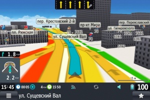
In the video, you can clearly see how the tablet works as a navigator:
First connection method. Via bluetooth
We turn on the tablet and the module. On the first, we connect Bluetooth, and wait until they begin to interact.

Next, we enter a password for connecting devices to each other (usually the password is three zeros). In the settings of the tablet, we allow the use of GPS to determine the location. Thus, we got a full-fledged navigator or tablet with GPS.
If the navigator does not connect to the module, you will need to download the Bluetooth GPS Provider program from the Play Market. You will have to run it every time you turn on the navigator on your tablet.
The second connection method is via USB
The first option is a little simpler than this one. First, download and run the USB GPS 4 Droid program. In the process of its work, we mark it with a quotation mark Start-Stop GPS. By these actions, we activate the Choose GPS device speed item, in which you need to enter the code that is indicated on the receiver. Further, in the settings of the tablet, go to the "For Developers" application, mark the "Fictitious location" column in it. Everything is ready, we launch the navigator and check its work.
The variety of choice of navigation software for android pleases the eye, at the same time and frightens an inexperienced person with its quantity. There is a choice - to use the free version or buy the program in a specialized store, download and install the navigator on the tablet for free.
Required Properties for a Navigator Tablet
It makes no sense to use devices less than 5 inches in diameter for this purpose. A tablet of 10 inches or more is a completely different matter. Everything will be perfectly visible on it, and a very large one will reduce the driver's view. Therefore, the most optimal device for using a tablet as a navigator in a car will be a device with a screen size of 7-8 inches.
Which operating system of the tablet is preferable for the navigator, of course - android. The advantage over others is ease of use and installation, transparency of settings and a large number of different devices. When purchasing a new device, it is best to purchase a tablet with GPS and 3G support. Although all tablets currently on offer have some pretty strong components that can handle just about any task. But still, the presence of GPS guarantees that there will be no need to purchase an additional module, and 3G will allow you to use the device to a greater extent and will allow you to load traffic jams while the car is moving.
Not all manufacturers ship the device with a holder. Therefore, you should think in advance about how you will use the navigator on your tablet while driving.
If the navigator program for the tablet is not installed on your device, then you have to choose one of the many applications for navigation. Domestic manufacturers and application developers offer a variety of high-quality products to choose from. Let's consider a few of the most common ones.
Navitel Navigator
The application is actively leading in terms of the number of users of smartphones, tablets and navigators. He owns about 60% of all sales and downloads. It differs in that it is inherent in multi-platform and support for a large number of different languages. Navitel Navigator also has extensive technical support.


This application is one of the most widely promoted developments in Yandex. All maps of this application are updated and loaded onto the device gradually, as needed. Its advantage is the ability to view photographs of monuments, landmarks and buildings that other users upload to the network. Another plus is that the application has a voice prompts module.

The fact that this domestic development belongs to highly functional applications is evidenced by the fact that the Togliatti Automobile Plant installs it on the built-in navigators of its cars, and the commercial licensed version of the application is used by many transport companies. The main advantage is the presence of the technology "Cork 2.0". It displays the situation much faster than competitors (Navitel or ProGorod).
The operation of this application is simple and does not require any additional skills. The advantage is the presence of a system of dynamic corrections that reflect real situations occurring on the road.

One of the most widespread navigators that do not require the Internet. The destination is marked with a red flag, you can set it with a dot on the map or by entering a specific address in the search bar. The downside is that the free version of the app only allows you to download 10 maps.

The free version runs smoothly and guides the user through 2D maps. All downloaded maps are updated at least once a month. The downside is the lack of voice prompts and limited access to 3D maps. These options are only present in the paid version of the application.
Benefits of using 3G GPS in your car
- Calculates the average fuel consumption and calculates the cost of the distance traveled.
- Check the accuracy of the vehicle speedometer.
- It will help you find a hotel, cafe or shop with an ATM.
- With it, it will be possible to view the weather forecast or news via the Internet.
- Check your email or social media page.
- Play a game or watch a movie at the bus stop.
- The battery capacity of the tablet computer is higher than that of navigators.
But most of all of the above is available when the corresponding programs and applications (software) are installed on the device.
Cons of using the tablet as a navigator in the car
To a greater extent, there is no panel mount for tablets, so you have to think of it yourself. The GPS module is powerful only on expensive models, the use of cheaper devices is fraught with the fact that the signal may periodically disappear (for large cities this may appear when driving through tunnels, bridges and overpasses).
Currently, Chinese manufacturers offer their customers a tablet with a TV tuner and navigator, as well as a tablet navigator and a video recorder. These devices, as a rule, belong to little-known manufacturers, but they differ from branded ones precisely in their wide functionality. The price for them is naturally lower than for the goods of well-known brands.
Attention! In the event of a breakdown or any malfunction, the user will have to decide on the repair or return of funds by mailing the device at his own expense to the Middle Kingdom.
When buying a branded device, it is enough to contact a service center that repairs phones, laptops, navigators, tablets and other equipment.
In a car, it is a very useful and important device that will help both a young car enthusiast and even an experienced driver. It is worth noting that many modern models allow not only choosing the most convenient and shortest route, but also bypassing traffic jams and choosing the best and safest route of travel.
Connecting a navigator is not difficult at all. This process does not require specific knowledge and skills. Of course, there is a nuance in the installation of a navigation device. Installation depends on the price category and complexity of the device.
How to connect GPS navigator correctly?
So, we focus on the price. Most of the modern navigators that are sold in the automotive markets can be divided into approximately 3 categories. The first includes those models, the price of which is below $ 200. They are the easiest to use. They are equipped with a minimum of functions. Such models rarely come with software. And if it is, then everyone can figure it out. Connecting a navigator of this price category will take just 15 minutes.
The second category includes navigation devices, the cost of which ranges from $ 200-500. GPS navigators in this category are much more common than others. Most car enthusiasts are inclined towards just such models. Such devices have rich functionality, detailed maps of the area. Of course, a connection diagram is also adapted to such devices.
The third category today includes those car navigators, the price of which is more than $ 500. Such devices are premium class. They just have a huge number of opportunities. It is the installation of such models that raises a large number of questions.
Connecting a GPS navigator with your own hands will take just a few minutes. Models of the second category work only in tandem with a PDA or laptop. The device connects to them using WIFI, Bluetooth or USB cable. After the connection is made, you need to download the special software that is included in the navigation device. After that, the navigator will be able to catch signals and you can work with it in peace.
It is worth noting that navigators that belong to the second category are usually equipped with an external antenna. Naturally, immediately after switching on, the device should receive a satellite signal. If this does not happen, then you must turn off the device and turn it on again. Such GPS navigators also need to be connected to a computer using a USB cable or Bluetooth. Make sure that the antenna is not covered by other objects.
As for the models of the third category, they have complex software. The driver should carefully study it and connect exactly the functions that he needs. To do this, you must strictly follow the instructions included with the device, which will help you correctly connect the navigator to the car.