Smartphones have long ceased to be simple "dialers". They have opened up a lot of new opportunities for their owners.
In the first place is full-fledged high-speed Internet access and communication in social networks and instant messengers. But no less in demand is GPS positioning, which we will now discuss in detail.
What is GPS?
GPS is a navigation system that determines the location of the smartphone, builds routes and allows you to find the desired object on the map.
Almost every modern gadget has a built-in GPS module. This is an antenna tuned to the GPS satellite signal. It was originally developed in the United States for military purposes, but later its signal became available to everyone. The gadget's GPS module is a receiving antenna with an amplifier, but it cannot transmit a signal. Receiving a signal from satellites, the smartphone determines the coordinates of its location.
Almost every modern person has at least once used GPS navigation on a smartphone or tablet. The need for it can arise at any time for people of different professions and different occupations. It is necessary for drivers, couriers, hunters, fishermen and even ordinary pedestrians who find themselves in an unfamiliar city. Thanks to such navigation, you can determine your location, find the desired object on the map, build a route, and if you have Internet access, bypass traffic jams.

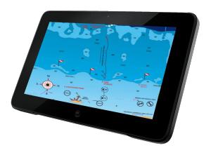
Offline maps for GPS
Google has developed a special geolocation application for its Android operating system - Google Maps. It quickly finds satellites, develops routes to facilities and suggests alternatives. Unfortunately, in the absence of a cellular network coverage area, Google Maps does not work, since geographic maps are loaded here via the Internet.
For offline navigation, the best solution is to download apps that support offline maps, such as Maps.me, Navitel and 2GIS. You can also install the Maps: Transport and Navigation application for Google Maps.

In this case, you will not have to spend Internet traffic to download maps - they will always be in your device, regardless of location. This is especially true when you are abroad, since the cost of roaming for Internet access is very high.
How to enable GPS on Android?
The GPS module can be activated in the Android operating system in two ways:
- Upper curtain. Swipe down on the display and in the menu that opens, click the button "Location", "Geolocation" or "Geodata" (depending on the version of Android).
- In the Android settings, find the item similar items, move the checkbox to the "Enabled" position.

During the active operation of the smartphone's navigation system, its battery charge begins to be consumed quite actively, so you should take care of additional power sources. For example, when driving, you need to use a car charger, and when traveling by bike or on foot -.
It is also worth remembering that reliable reception of a satellite signal is possible in an open area, so when you are in a room or a tunnel, geolocation becomes impossible. Cloudy weather also affects - because of the clouds, the device searches for satellites longer and less accurately determines its coordinates.

Not so long ago, GPS was the only geolocation system, so in earlier versions of Android only it was mentioned, and the button for activating the service was called that. Since 2010, the Russian one has fully earned, and since 2012 -.
As is often the case with high-tech projects, the military initiated the development and implementation of the GPS (Global Positioning System) system. The project of a satellite network for determining coordinates in real time anywhere in the world was called Navstar (Navigation system with timing and ranging), while the abbreviation GPS appeared later, when the system began to be used not only in defense, but also for civilian purposes.
The first steps to deploy the navigation network were taken in the mid-seventies, while the commercial operation of the system in its current form began in 1995. At the moment, 28 satellites are in operation, evenly distributed over orbits with an altitude of 20350 km (24 satellites are sufficient for fully functional operation).
Running a little ahead of myself, I will say that truly a key moment in the history of GPS was the decision of the President of the United States to abolish the so-called selective availability (SA - selective availability) from May 1, 2000 - an error artificially introduced into satellite signals for the inaccurate operation of civil GPS receivers. ... From that moment on, an amateur terminal can determine coordinates with an accuracy of several meters (previously, the error was tens of meters)! Figure 1 shows errors in navigation before and after disabling the selective access mode (data).
Let's try to understand in general terms how the global positioning system works, and then we will touch on a number of user aspects. Let us begin our consideration with the principle of determining the range, which underlies the operation of the space navigation system.
Algorithm for measuring the distance from the observation point to the satellite.
Ranging is based on calculating the distance from the time delay of the propagation of the radio signal from the satellite to the receiver. If you know the propagation time of a radio signal, then the path traveled by it is easy to calculate by simply multiplying the time by the speed of light.
Each GPS satellite continuously generates radio waves of two frequencies - L1 = 1575.42MHz and L2 = 1227.60MHz. The transmitter power is 50 and 8 watts, respectively. The navigation signal is a Pseudo Random Number code (PRN). PRN is of two types: the first, the C / A-code (Coarse Acquisition code - rough code) is used in civil receivers, the second P-code (Precision code - exact code), is used for military purposes, and also, sometimes, for solving problems geodesy and cartography. The L1 frequency is modulated by both the C / A and the P-code, the L2 frequency exists only for the transmission of the P-code. In addition to those described, there is also a Y-code, which is an encrypted P-code (in wartime, the encryption system can change).
The repetition period of the code is quite long (for example, for a P-code it is 267 days). Each GPS receiver has its own oscillator, which operates on the same frequency and modulates the signal according to the same law as the satellite oscillator. Thus, from the delay time between the same sections of the code received from the satellite and generated independently, it is possible to calculate the propagation time of the signal, and, consequently, the distance to the satellite.
One of the main technical difficulties of the method described above is the synchronization of clocks on the satellite and in the receiver. Even a minuscule error by conventional standards can lead to a huge error in determining the distance. Each satellite carries a high-precision atomic clock on board. It is clear that it is impossible to install such a thing in every receiver. Therefore, to correct errors in determining coordinates due to errors of the clock built into the receiver, some redundancy is used in the data necessary for unambiguous binding to the terrain (more on this a little later).
In addition to the navigation signals themselves, the satellite continuously transmits various kinds of service information. The receiver receives, for example, ephemeris (accurate data about the satellite's orbit), the forecast of the propagation delay of the radio signal in the ionosphere (since the speed of light changes when passing through different layers of the atmosphere), as well as information about the satellite's performance (the so-called "almanac" containing updates every 12.5 minutes information about the state and orbits of all satellites). This data is transmitted at 50 bps on the L1 or L2 frequencies.
General principles of determining coordinates using GPS.
The basis of the idea of determining the coordinates of a GPS receiver is to calculate the distance from it to several satellites, the location of which is considered known (this data is contained in the almanac received from the satellite). In geodesy, the method of calculating the position of an object by measuring its distance from points with given coordinates is called trilateration.  Fig2.
Fig2.
If the distance A to one satellite is known, then the coordinates of the receiver cannot be determined (it can be located at any point of the sphere with radius A, described around the satellite). Let the distance B of the receiver from the second satellite be known. In this case, the determination of coordinates is also not possible - the object is somewhere on a circle (it is shown in blue in Fig. 2), which is the intersection of two spheres. The distance C to the third satellite reduces the uncertainty in coordinates to two points (indicated by two bold blue dots in Fig. 2). This is already enough to unambiguously determine the coordinates - the fact is that of the two possible points of location of the receiver, only one is on the surface of the Earth (or in the immediate vicinity of it), and the second, false, turns out to be either deep inside the Earth or very high above it surface. Thus, theoretically, for three-dimensional navigation, it is sufficient to know the distances from the receiver to three satellites.
However, in life everything is not so simple. The above reasoning was made for the case when the distances from the observation point to the satellites are known with absolute accuracy. Of course, no matter how sophisticated the engineers are, some error always occurs (at least due to the inaccurate synchronization of the receiver and satellite clocks indicated in the previous section, the dependence of the speed of light on the state of the atmosphere, etc.). Therefore, to determine the three-dimensional coordinates of the receiver, not three, but at least four satellites are involved.
Having received a signal from four (or more) satellites, the receiver searches for the intersection point of the corresponding spheres. If there is no such point, the receiver processor begins to adjust its clock by the method of successive approximations until it reaches the intersection of all spheres at one point.
It should be noted that the accuracy of determining the coordinates is associated not only with the precise calculation of the distance from the receiver to the satellites, but also with the magnitude of the error in specifying the location of the satellites themselves. To control the orbits and coordinates of satellites, there are four ground tracking stations, communication systems and a command center, controlled by the US Department of Defense. Tracking stations constantly monitor all satellites in the system and transmit data about their orbits to the control center, where updated trajectory elements and satellite clock corrections are calculated. These parameters are entered into the almanac and transmitted to the satellites, and they, in turn, send this information to all working receivers.
In addition to the above, there are many special systems that increase the accuracy of navigation - for example, special signal processing schemes reduce errors from interference (interaction of a direct satellite signal with a reflected one, for example, from buildings). We will not delve into the specifics of the functioning of these devices, so as not to unnecessarily complicate the text.
After the cancellation of the selective access mode described above, civil receivers are "tied to the terrain" with an error of 3-5 meters (the height is determined with an accuracy of about 10 meters). The above figures correspond to the simultaneous reception of a signal from 6-8 satellites (most modern devices have a 12-channel receiver, which allows simultaneous processing of information from 12 satellites).
The so-called differential correction mode (DGPS - Differential GPS) allows to qualitatively reduce the error (up to several centimeters) in the measurement of coordinates. Differential mode consists in using two receivers - one is stationary at a point with known coordinates and is called "base", and the second, as before, is mobile. The data received by the base receiver is used to correct the information collected by the mobile vehicle. Correction can be carried out both in real time and during "offline" data processing, for example, on a computer.
Typically, a professional receiver owned by a navigation or surveying company is used as the base. For example, in February 1998, near St. Petersburg, the NavGeoCom company installed the first differential GPS ground station in Russia. The transmitter power of the station is 100 watts (frequency 298.5 kHz), which allows using DGPS at a distance from the station at a distance of up to 300 km by sea and up to 150 km by land. In addition to ground based receivers, OmniStar's satellite differential service system can be used for differential GPS data correction. Correction data is transmitted from several geostationary satellites of the company.
It should be noted that the main customers of differential correction are geodetic and topographic services - for a private user, DGPS is not of interest due to its high cost (the OmniStar service package in Europe costs more than $ 1,500 per year) and the bulkiness of the equipment. And it is unlikely that in everyday life there are situations when you need to know your absolute geographic coordinates with an error of 10-30 cm.
In conclusion of the part about the "theoretical" aspects of GPS functioning, I will say that Russia, in the case of space navigation, has gone its own way and is developing its own GLONASS system (GLOBAL NAVIGATION SATELLITE SYSTEM). But due to the lack of proper investment, there are currently only seven satellites in orbit out of twenty-four necessary for the normal functioning of the system ...
Brief subjective notes of the GPS user.
It just so happened that in the ninety-seventh year I learned about the ability to determine my location using a wearable device the size of a cell phone from a magazine. However, the wonderful perspectives drawn by the authors of the article were mercilessly shattered by the price of the navigation apparatus stated in the text - almost $ 400!
A year and a half later (in August 1998), fate brought me to a small sports shop in the American city of Boston. What was my surprise and joy when, on one of the windows, I accidentally noticed several different navigators, the most expensive of which cost $ 250 (unpretentious models were offered for $ 99). Of course, I could no longer leave the store without the device, so I began to torture the sellers about the characteristics, advantages and disadvantages of each model. I didn’t hear anything intelligible from them (and not at all because I don’t know English well), so I had to figure it out myself. And as a result, as is often the case, the most advanced and expensive model was purchased - Garmin GPS II +, as well as a special case for it and a power cord from the car cigarette lighter socket. The store had two more accessories for my now-my device - a device for attaching the navigator to a bicycle handlebar and a cord for connecting to a PC. I played the latter for a long time in my hands, but, in the end, I decided not to buy because of the considerable price (a little over $ 30). As it turned out later, I did not buy the cord quite correctly, because all the interaction of the device with the computer comes down to the "cream" in the computer of the traversed route (and also, I think, coordinates in real time, but there are certain doubts about this), and even then subject to the purchase of software from Garmin. Unfortunately, there is no possibility to load maps into the device.
 I will not give a detailed description of my device, if only because it has already been discontinued (those who want to get acquainted with the detailed technical characteristics can do this). I will only note that the weight of the navigator is 255 grams, the dimensions are 59x127x41 mm. Due to its triangular cross-section, the device is extremely stable on the table or dashboard of the car (Velcro is included in the package for a more secure fit). Power is supplied from four AA AA batteries (they only last for 24 hours of continuous operation) or an external source. I will try to tell you about the main capabilities of my device, which, I think, have the overwhelming majority of navigators on the market.
At first glance, GPS II + can be mistaken for a mobile phone released a couple of years ago. As soon as you look closely, you notice an unusually thick antenna, a huge display (56x38 mm!) And a small number of keys by phone standards.
When the device is turned on, the process of collecting information from satellites begins, and a simple animation appears on the screen (a rotating globe). After initial initialization (which takes a couple of minutes in an open place), a primitive sky map with the numbers of visible satellites appears on the display, and next to it is a histogram indicating the signal level from each satellite. In addition, the navigation error (in meters) is indicated - the more satellites the device sees, the more accurate the determination of coordinates will be.
The GPS II + interface is built on the principle of "flipping" pages (there is even a dedicated PAGE button for this). The "satellite page" was described above, and besides it, there is a "navigation page", "map", "return page", "menu page" and a number of others. It should be noted that the described device is not Russified, however, even with poor knowledge of English, you can understand its work.
The navigation page displays: absolute geographic coordinates, distance traveled, instantaneous and average speed, altitude, movement time and, at the top of the screen, an electronic compass. I must say that the height is determined with a much greater error than two horizontal coordinates (there is even a special remark in the user manual for this), which does not allow the use of GPS, for example, to determine the height by paragliders. But the instantaneous speed is calculated extremely accurately (especially for fast-moving objects), which makes it possible to use the device to determine the speed of snowmobiles (whose speedometers tend to lie significantly). I can give "bad advice" - after renting a car, turn off its speedometer (so that it counts less kilometers - after all, the payment is often proportional to the mileage), and determine the speed and distance traveled by GPS (since it can measure both in miles and in kilometers ).
The average speed of movement is determined according to a somewhat strange algorithm - idle time (when the instantaneous speed is zero) is not taken into account in the calculations (it would be more logical, in my opinion, to divide the distance traveled by the total travel time, but the creators of GPS II + were guided by some other considerations).
The distance traveled is displayed on the "map" (the device has enough memory for 800 kilometers - if the mileage is higher, the oldest marks are automatically erased), so if you want you can see the diagram of your walks. The scale of the map varies from tens of meters to hundreds of kilometers, which is undoubtedly extremely convenient. The most remarkable thing is that in the memory of the device there are coordinates of the main settlements of the whole world! The United States, of course, is represented in more detail (for example, all areas of Boston are present on the map with names) than Russia (the location of only cities such as Moscow, Tver, Podolsk, etc. is indicated here). Imagine, for example, that you are heading from Moscow to Brest. Find in the memory of the navigator "Brest", press the special button "GO TO", and the local direction of your movement appears on the screen; global direction to Brest; the number of kilometers (in a straight line, of course) remaining to the destination; average speed and estimated time of arrival. And so anywhere in the world - even in the Czech Republic, even in Australia, even in Thailand ...
Equally useful is the so-called return function. The memory of the device allows you to record up to 500 key points (waypoints). The user can name each point at his own discretion (for example, DOM, DACHA, etc.), various icons are also provided for displaying information on the display. By turning on the function of returning to the point (any of the pre-recorded ones), the owner of the navigator gets the same possibilities as in the case with Brest described above (i.e. distance to the point, estimated time of arrival, and everything else). For example, I had such a case. Arriving in Prague by car and settling in a hotel, my friend and I went to the city center. Leaving the car in the parking lot, we went for a walk. After an aimless three-hour walk and dinner at a restaurant, we realized that we had absolutely no memory of where we left the car. It's night outside, we are in one of the small streets of an unfamiliar city ... Fortunately, before leaving the car, I wrote down its location in the navigator. Now, having pressed a couple of buttons on the device, I learned that the car was standing 500 meters away from us and in 15 minutes we were already listening to quiet music, heading to the hotel by car.
In addition to moving to the recorded mark in a straight line, which is not always convenient in city conditions, Garmin offers a TrackBack function - a return on your way. Roughly speaking, the curve of motion is approximated by a number of straight sections, and marks are placed at the break points. On each straight-line section, the navigator guides the user to the nearest mark, and upon reaching it, it automatically switches to the next mark. An extremely convenient function when driving a car in unfamiliar terrain (of course, the signal from satellites does not pass through buildings, therefore, in order to obtain data on your coordinates in a densely built environment, you have to look for a more or less open place).
I will not delve further into the description of the device's capabilities - believe me, in addition to those described, it also has a lot of pleasant and necessary gadgets. One change of display orientation is worth it - you can use the device both in a horizontal (automobile) and vertical (pedestrian) position (see Fig. 3).
One of the main advantages of GPS for the user, I consider the absence of any payment for using the system. I bought the device once - and enjoy!
Conclusion.
I think there is no need to list the areas of application of the considered global positioning system. GPS receivers are built into cars, Cell Phones and even a wristwatch! Recently, I came across a message about the development of a chip that combines a miniature GPS receiver and a GSM module - it is proposed to equip dog collars with devices based on it, so that the owner can easily find a lost dog through the cellular network.
But in any barrel of honey there is a fly in the ointment. In this case, Russian laws act as the latter. I will not discuss in detail the legal aspects of using GPS navigators in Russia (something can be found about this), I will only note that theoretically high-precision navigation devices (which, no doubt, even amateur GPS receivers are) are prohibited in our country, and their the owners are waiting for the confiscation of the device and a considerable fine.
Fortunately for users, in Russia the strictness of the laws is compensated by the non-obligation of their implementation - for example, a huge number of limousines with a washer-antenna of GPS receivers on the trunk lid are driving around Moscow. All more or less serious sea vessels are equipped with GPS (and a whole generation of yachtsmen has already grown up, having difficulty navigating in space using a compass and other traditional means of navigation). I hope the authorities will not put a spoke in the wheels of technical progress and will soon legalize the use of GPS receivers in our country (they have canceled the permissions for cell phones), and will also give the go-ahead for declassification and replication of detailed maps of the area necessary for the full use of car navigation systems.
Today we will talk about what GPS is, how this system works. Let's pay attention to the development of this technology, its functional features. We will also discuss the role of interactive maps in the operation of the system.
The history of the emergence of GPS
The history of the emergence of a global positioning system, or determination of coordinates, began in the United States back in the distant 50s when the first Soviet satellite was launched into space. A team of American scientists who followed the launch noticed that the satellite uniformly changes its signal frequency with distance. After a deep analysis of the data, they came to the conclusion that with the help of the satellite, in more detail, its location and the emitted signal, it is possible to accurately determine the location and speed of a person's movement on the ground, as well as vice versa, the speed and location of the satellite in orbit when determining the exact coordinates of the person. By the end of the seventies, the US Department of Defense launched the GPS system for its own purposes, and a few years later it became available for civilian use. How does the GPS system work now? Exactly how it worked at that time, according to the same principles and principles.
Satellite network

More than twenty-four satellites in low-earth orbit transmit referencing radio signals. The number of satellites varies, but the required number of satellites is always in orbit to ensure uninterrupted operation, plus some of them are in stock to take over their functions in the event of a breakdown. Since the service life of each of them is approximately 10 years, new, modernized versions are launched. The satellites rotate in six orbits around the Earth at an altitude of less than 20 thousand km, it forms an interconnected network, which is controlled by GPS stations. The latter are located on tropical islands and are associated with the main focal point in the United States.
How does a GPS navigator work?

Thanks to this network, it is possible to find out the location by calculating the propagation delay of the signal from the satellites, and using this information to determine the coordinates. How does the GPS system work now? Like any space navigation network, it is completely free. It works with high efficiency in all weather conditions and at any time of the day. The only purchase you should have is a GPS navigator itself or a device that supports GPS functions. Actually, the operating principle of the navigator is based on a long-used simple navigation scheme: if you know exactly where the marker object is located, which is most suitable for the role of a landmark, and the distance from it to you, draw a circle on which you indicate your location with a dot. If the radius of the circle is large, then replace it with a straight line. Draw several such stripes from your possible location towards the markers, the intersection point of the lines will indicate your coordinates on the map. In this case, the aforementioned satellites just play the role of these marker objects with a distance of about 18 thousand km from your location. Although they rotate in orbit at a tremendous speed, their location is constantly tracked. Each navigator has a GPS receiver, which is programmed to the desired frequency and is in direct interaction with the satellite. Each radio signal contains a certain amount of coded information, which includes statements about the technical condition of the satellite, its location in Earth's orbit and the time zone (exact time). By the way, information about the exact time is the most necessary for obtaining data about your coordinates: the ongoing calculation of the time interval between the transmission and reception of the radio signal is multiplied by the speed of the radio wave itself and, by means of short-term calculations, the distance between your navigation device and the satellite in orbit is calculated.
Synchronization difficulties

Based on this principle of navigation, it can be assumed that to accurately determine your coordinates, you may need only two satellites, based on the signals of which it will be easy to find the intersection point, and as a result - the place where you are. But, unfortunately, technical reasons require the use of one more satellite as a marker. The main problem is the clock of the GPS receiver, which does not allow sufficient synchronization with the satellites. The reason for this is the difference in the time display (on your navigator and in space). The satellites have expensive high-quality atomic-based clocks, which allows them to keep track of the time with the utmost accuracy, while it is simply impossible to use such chronometers on conventional receivers, since the dimensions, cost, and complexity of operation would not allow them to be used everywhere. Even a small error of 0.001 seconds can shift the coordinates by more than 200 km to the side!
Third marker

So the developers decided to leave the usual technology of quartz watches in GPS navigators and go the other way, to be more precise - to use instead of two landmarks-satellites - three, respectively, the same number of lines for subsequent crossing. The solution to the problem is based on an ingeniously simple way out: when all the lines from the three marked markers intersect, even with possible inaccuracies, a triangle-shaped zone is created, the center of which is taken from its middle - your location. It also allows you to identify the difference in time between the receiver and all three satellites (for which the difference will be the same), which allows you to correct the intersection of the lines exactly in the center, in other words, this determines your GPS coordinates.
One frequency
It should also be noted that all satellites send information to your device on the same frequency, which is quite unusual. How does a GPS navigator work and how does it perceive all information correctly if all satellites continuously and simultaneously send information to it? It's pretty simple. To identify themselves, transmitters on the satellite also send standard information in the radio signal, which contains an encrypted code. It reports the maximum characteristics of the satellite and is entered into the database of your device, which then allows you to verify the data from the satellite with the navigator's database. Even with a large number of satellites in range, they can be identified very quickly and easily. All this simplifies the whole scheme and allows using smaller and weaker receiving antennas in GPS navigators, which makes the design and dimensions of the devices cheaper and smaller.
GPS Maps
GPS maps are downloaded to your device separately, as you yourself influence the choice of the terrain in which you want to navigate. The system just sets your coordinates on the planet, and the function of the maps is to recreate on the screen a graphical version on which the coordinates are applied, which allows you to navigate the terrain. How does GPS work in this case? Free, it continues to remain in this status, cards in some online stores (and not only) are still paid. Often, separate applications for working with maps are created for a device with a GPS navigator: both paid and free. The variety of maps pleasantly surprises and allows you to set up the road from point A to point B in the most informative way and with all the conveniences: what sights you will pass, the shortest path to your destination, a voice assistant indicating the direction, and others.
Additional GPS equipment
The GPS system is used not only to show you the right path. It allows you to track an object on which a so-called beacon or GPS tracker may be located. It consists of the signal receiver itself and a transmitter based on gsm, 3gp or other communication protocols for transmitting information about the location of the object to the service centers that exercise control. They are used in many industries: security, medical, insurance, transport and many others. There are also vehicle trackers that connect exclusively to the vehicle.
Travel without problems

With each passing day, the values of the map and the permanent compass go further and further into the past. Modern technologies allow a person to pave the way for his journey with minimal loss of time, effort and money, while seeing the most exciting and interesting places. What was fiction about a century ago has now become a reality, and almost everyone can take advantage of it: from the military, sailors and airplane pilots to tourists and couriers. Nowadays, the use of these systems for the commercial, entertainment, advertising industries is also gaining great popularity, where every entrepreneur can indicate himself on the global map of the world, and it will not be difficult to find him at all. We hope that this article helped everyone who is interested in GPS - how it works, on what principle is the determination of coordinates, what are its strengths and weaknesses.
Almost every modern phone already has a built-in GPS-receiver module, with the help of which it is possible to accurately determine its location on planet Earth. To work and accurately determine the location of the GPS does not require the Internet and towers of mobile networks. The system can work even in the middle of the desert, far from civilization. We know this is possible thanks to satellites - but how exactly does it work?
The GPS system is based on navigation satellites moving around the Earth along 6 circular orbital trajectories (4 satellites in each), at an altitude of 20180 km. GPS satellites orbit the Earth in 12 hours, their weight in orbit is about 840 kg, dimensions are 1.52 m wide and 5.33 m long, including solar panels generating 800 watts of power.
24 satellites ensure 100% performance of the GPS navigation system anywhere in the world. The maximum possible number of simultaneously operating satellites in the NAVSTAR system is limited to 37. There are almost always 32 satellites in orbit, 24 primary and 8 backup in case of failures.

Since it is known that each of the satellites makes two revolutions around the planet per day, it becomes easy to calculate that their speed is approximately 14,000 km / h. The very location of the satellites, as well as the inclination of their orbits, is by no means accidental: they are located so that at least four satellites can be seen from any open point on the planet - this is the minimum number required to determine the location of an object on Earth. Why exactly four and how does it work?
To measure some very long distance, we can send a signal and measure the time it takes for it to reach the desired point or reflect from it and reach us again (the main thing is to know exactly the speed of the signal movement). In the second case, the time will have to be divided by two, since the signal has traveled twice the distance. This method is called echolocation, and the range of its application is very wide: from studying the shape of the seabed (here the signal is ultrasound) and ending with radars (the signal is electromagnetic waves).
The problem is that when using this method, we need to know in advance where the receiver is. In the case of the GPS system, the receiver of the signal is you, standing on Earth. The satellite has no idea about your location, it does not know where you are, and will never know, so it sends a signal immediately to the entire surface of the planet below it. In this signal, he encodes information about where he is located, as well as at what time, according to his own clock, the signal was sent, and this is where his work ends.
The GPS-module in your hands received the coordinates of the satellite and information about the time of sending the signal. The program in your phone multiplies the speed of propagation of the signal (that is, the speed of light) by the difference between the time it was received and the time it was sent, thus calculating the distance to each satellite. If the module's clocks were exactly synchronized with the clocks of all satellites, then two more satellites would be needed to determine the position using the so-called triangulation.
To understand how triangulation works, let's go into two-dimensional space for a second. Imagine two points on a plane located at a known distance from each other, say 5 meters. You also know that some new point is, in turn, at known distances from the first two - for example, 3 and 4 meters, respectively. To find this new point, you can draw two circles with radii of 3 and 4 meters and centers at the first and second points, respectively. The two obtained circles intersect at exactly two points, one of which will be the desired one.
Let's go back to three-dimensional space. Now we already need three reference points, which are our satellites, and we will not "draw" circles around them, but spheres. All three spheres at once, in the general case, will have two intersection points, but one of them is located "above" the location of the satellites, very high in space - we clearly do not need it. But the second is just your location.
To measure a location in space, you need to know the exact time and have an accurate instrument to measure it.
The real task is complicated by the fact that the time on your phone's clock does not coincide with that of the satellites, and your clock is several orders of magnitude less accurate. Generally speaking, time creates several additional complications in solving this problem. For example, satellites are subject to the effects of relativistic and gravitational time distortion. In fact, the speed of the clock, according to the theory of relativity, depends, among other things, on the force of gravity at the point where the clock is located, as well as on the speed of its movement.
At an altitude of 20,000 kilometers above the Earth, gravity is rather weak, and satellites fly, as we have already figured out, rather quickly. Due to the sum of these effects, the clock has to be adjusted by a total of 38 milliseconds per day. If it seems that this is not enough, let me remind you that an electromagnetic signal moving at the speed of light will travel approximately 11,000 km during this time - approximately the same, and there may be an error in determining the coordinates.
The second problem is the accuracy of the watch itself. At the indicated signal rates, every millionth of a second, measured with an error, can cause large errors. Because of this, satellites of the old format allow determining the location not very accurately and can "deceive" as much as 10 meters. Since 2010, new satellites equipped with atomic clocks have been launched to replace the old ones, and their error has decreased to 1 meter.
Another way to solve the problem is to use special ground correction stations. They are used on the territory of some countries and the principle of their work is as follows: taking data on the location of an object, they correct them, and as a result, the user of the gadget receives more reliable information about his own location.
The more signal sources, the more accurate the measurement result, which is why it will be easier to navigate in a metropolis using a navigator than in a desert.
However, atomic clocks are cumbersome and expensive, so another satellite is needed to solve the receiver timing problem. It also transmits information about its location and the moment of sending the signal. And now our space becomes not three-dimensional, but four-dimensional. The unknowns are the latitude, longitude, altitude and time of the receiver at the time of sending the signals. The position in these four dimensions is what we need to determine, for which, by analogy with two-dimensional and three-dimensional spaces, we need exactly four satellites.
Of course, in reality it is good when it is possible to "catch" a signal from a larger number of sources, and in large cities and populated areas there is no problem with this: you can easily see a dozen satellites at the same time, which will provide a sufficiently high accuracy for domestic use.
However, the initial search for satellites is also not an easy task. In old devices, the device could take a lot of time, up to several minutes, to catch and parse the signal from the required number of space objects. Then it was called "cold start", and in order to speed up the process, they came up with the idea of obtaining data on the current location of celestial bodies from the Internet. But when the receiver was moved over a long distance (tens of kilometers) or with a very long inactivity, the "cold start" had to be done anew. In modern devices, the module periodically turns on itself, updating the information, so this problem no longer exists.
By the way, until 2000, the accuracy for civilians was artificially lowered, and they were allowed to find out their location no closer than 100 meters from the real one. Since GPS was built, funded, and supported by the US Department of Defense, the military wanted a certain edge. With the development and more and more active introduction of technology into the life of the civilian population, this artificial limitation was removed.
The satellite does not receive data on any GPS devices on the surface of the Earth and in the air, therefore the service is free. We just won't be able to find out who exactly uses it. It turns out that a recipe for solving a common human problem, codenamed "Where am I?" extremely simple: one-way communication and simple mathematical calculations.
Today the field of application of the global positioning system GPS is quite extensive. Increasingly, GPS receivers are being built into mobile phones and communicators, cars, watches, and even dog collars. People get used to such a good thing as GPS navigation, and it won't be long before they can no longer do without it. That is why it is worth saying a few words about the disadvantages of GPS.
The disadvantages of GPS navigation are that under certain conditions the signal may not reach the GPS receiver, so it is almost impossible to determine your exact location in the depths of an apartment inside a reinforced concrete building, in a basement or in a tunnel.
The operating frequency of GPS is in the decimeter range of radio waves, so the signal reception from satellites may deteriorate under dense foliage of trees, in areas with dense urban development or due to large clouds, and this will affect positioning accuracy.
Magnetic storms and terrestrial radio sources can also interfere with the normal reception of GPS signals.
Maps designed for GPS navigation quickly become outdated and can be inaccurate, so you need to trust not only the data from the GPS receiver, but also your own eyes.
It is especially worth noting that the operation of the global GPS navigation system is completely dependent on the US Department of Defense and one cannot be sure that at any given time the US will not turn on the jamming (SA - selective availability) or completely disable the civil GPS sector altogether both in a particular region, as well as and generally speaking. There have already been precedents.
The GPS system has a less popular and well-known alternative in the form of the GLONASS (Russia) and Galileo (EU) navigation systems, and each of these systems is striving to gain widespread adoption.